One warming stretch of the Pacific could bring very different challenges to two places at the heart of HERO’s work: a wetter winter in California, and greater heat and water stress in Panama.
El Niño is strengthening, and forecasters say it could become an unusually powerful event. For California, that raises questions about flooding, coastal erosion and winter water supplies. In Panama, the concerns reach from rainforest seedlings and mountain cloud forests to coral reefs and the resident dolphins of Bocas del Toro.
The connections are real, but the outcome is still unfolding. A strong El Niño shifts the odds of certain conditions; it does not determine the weather in every place.
How a warmer Pacific changes the weather
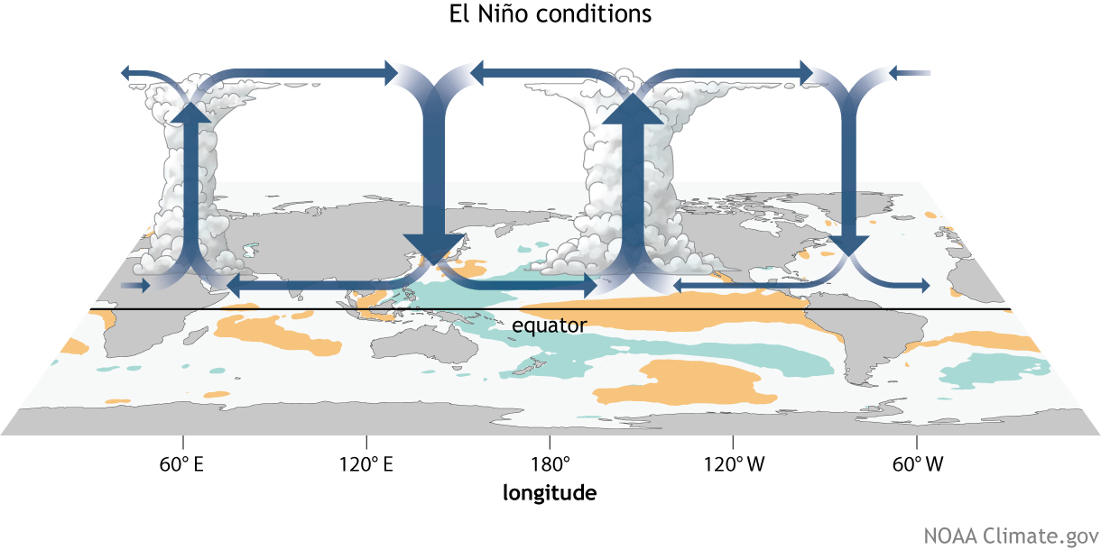
El Niño is the warm phase of the El Niño–Southern Oscillation, or ENSO, a recurring pattern in the tropical Pacific. Normally, trade winds push warm surface water westward. When those winds weaken, warm water spreads east, while the rise of cooler water from below is reduced.
That rearrangement changes where tropical rainstorms form. It can also shift the jet stream and the paths of storms thousands of miles away. Heat stored beneath the ocean surface helps scientists judge whether the warming is likely to continue.
El Niño is a natural climate cycle occurring against a background of human-caused warming. NOAA now uses the Relative Oceanic Niño Index, or RONI, to distinguish the Pacific pattern from broader warming across the tropics. Why NOAA uses RONI.
What the October forecasts say
In its October 8 discussion, NOAA’s Climate Prediction Center gave an 83% chance that the October–December RONI would reach at least +2.5°C. That would exceed previous El Niño events in the RONI record dating to 1950. The same bulletin favored a strong to very strong event lasting through January–March 2027. NOAA’s ENSO discussion.
NOAA’s October 15 seasonal update reported a weekly Niño-3.4 sea-surface temperature anomaly of +2.4°C. Niño-3.4 measures a key area of the equatorial Pacific; a positive anomaly means warmer water than its usual average. These weekly readings and the three-month RONI are different measures and should not be compared directly.
A forecast, with room for change
A potentially historic event is a reason to prepare. Whether a particular watershed floods, a forest dries out or a reef bleaches still depends on local conditions and how the season develops.
California: prepare for a wetter winter
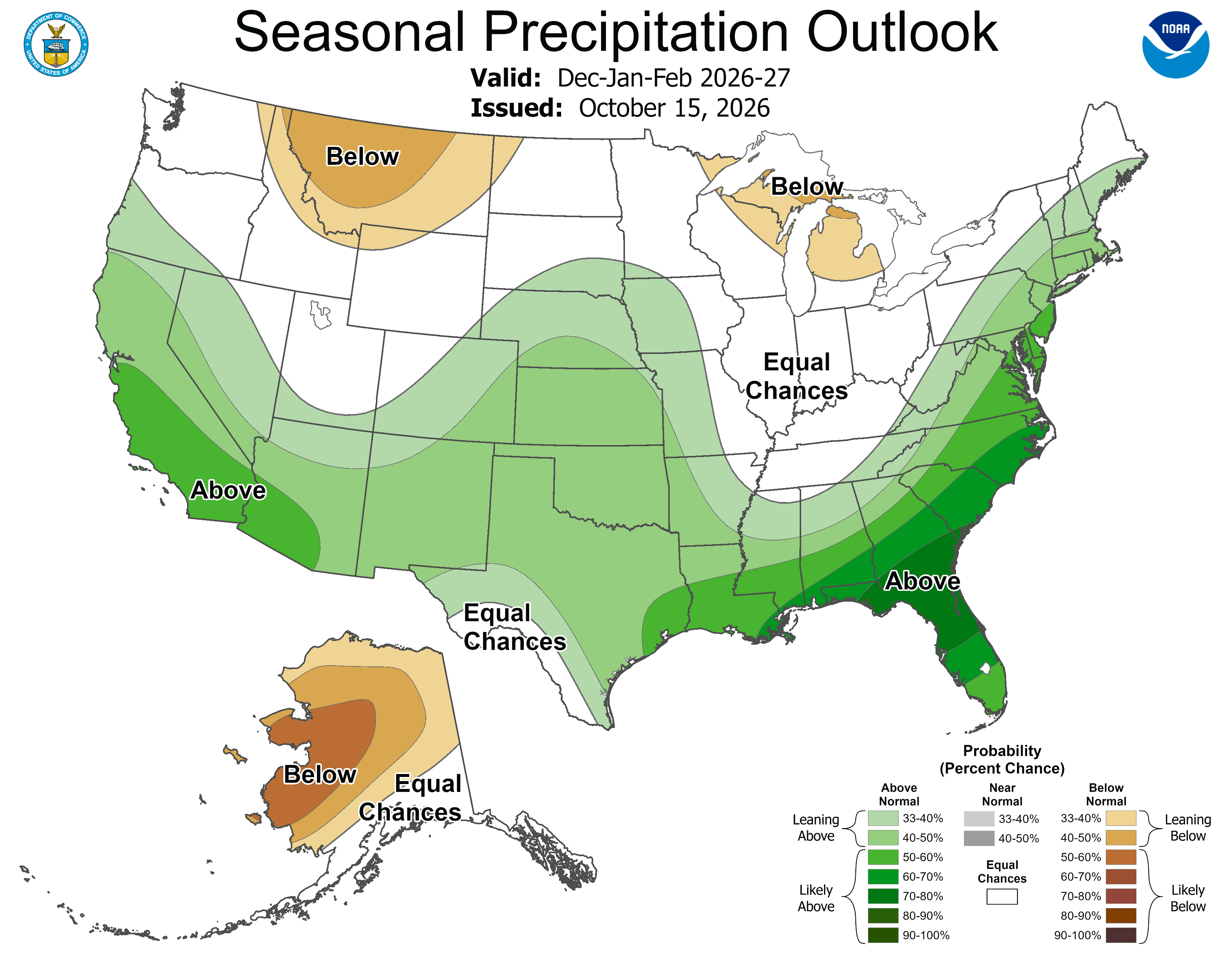
NOAA’s October 15 outlook favors above-average precipitation across much of California and the southern United States during the coming winter. The usual El Niño connection is stronger in Southern California, though the current outlook also extends the wetter signal farther north. NOAA’s seasonal outlook.
Past events show both the risk and the uncertainty. The winters of 1982–83 and 1997–98 brought destructive storms and flooding. Yet the powerful 2015–16 El Niño delivered statewide precipitation only a little above the long-term average. Ocean warmth alone does not decide where storms make landfall. NOAA’s look at the 2015–16 winter.
This season, the practical concerns include heavy rain, atmospheric rivers, debris flows in recently burned areas and damaging coastal surf. Warmer storms can also bring rain where snow would otherwise fall, changing how much water remains stored in the Sierra snowpack. Clearing drainage systems, preparing flood-control facilities and following local forecasts are useful steps before the storms arrive.
Panama: water stress from lowlands to cloud forests
In much of Panama, El Niño tends to bring hotter conditions and reduced rainfall, increasing pressure on forests, farms and water supplies. The effects vary across the country: the Caribbean coast and Bocas del Toro do not always follow the same rainfall pattern as the Pacific slope.
Even a rainforest can run short of water. Prolonged dry periods can make it harder for seedlings to establish and can stress mature trees. Research in Panama has found that forest age, tree size and drought adaptations help determine which trees cope and which are more vulnerable. Smithsonian research on Panama’s forests during the 2015–16 drought.
Cloud forests, including those in the Chiriquí highlands, depend on frequent moisture from rain and mist. If cloud cover and fog decline, plants growing on branches — such as orchids, bromeliads and ferns — may face longer periods without water. Studies of cloud-forest plants during severe drought show that responses differ among species and sites; losses should not be assumed everywhere. Research on cloud-forest epiphytes and drought.
The same water shortage reaches beyond the forest. During the 2023 drought, low reservoir levels forced the Panama Canal to reduce ship transits while conserving water for people. That experience makes watershed protection and early water planning especially relevant now. The Panama Canal’s account of the drought response.
Coral reefs: watch the heat, and how long it lasts
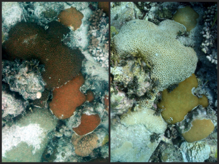
Panama’s Pacific reefs suffered severe bleaching and coral deaths during the 1982–83 and 1997–98 El Niño events. When water stays unusually warm, corals can lose the tiny algae that help feed them. Bleached corals can recover if conditions improve, but prolonged heat can kill them. Research comparing Panama’s reefs during those events.
Local conditions matter. Upwelling, currents, cloud cover and the length of a hot spell can make neighboring reefs respond differently. A forecast for the tropical Pacific cannot, by itself, tell us what will happen to a particular reef in Bocas del Toro on the Caribbean side. USGS on El Niño and reef resilience.
Reefs on both coasts need close attention as ocean temperatures rise. NOAA’s Coral Reef Watch tracks accumulated heat stress, providing a more useful warning than a single temperature reading. Reducing runoff, physical damage and other local pressures gives corals a better chance during a hot season. Follow NOAA Coral Reef Watch.
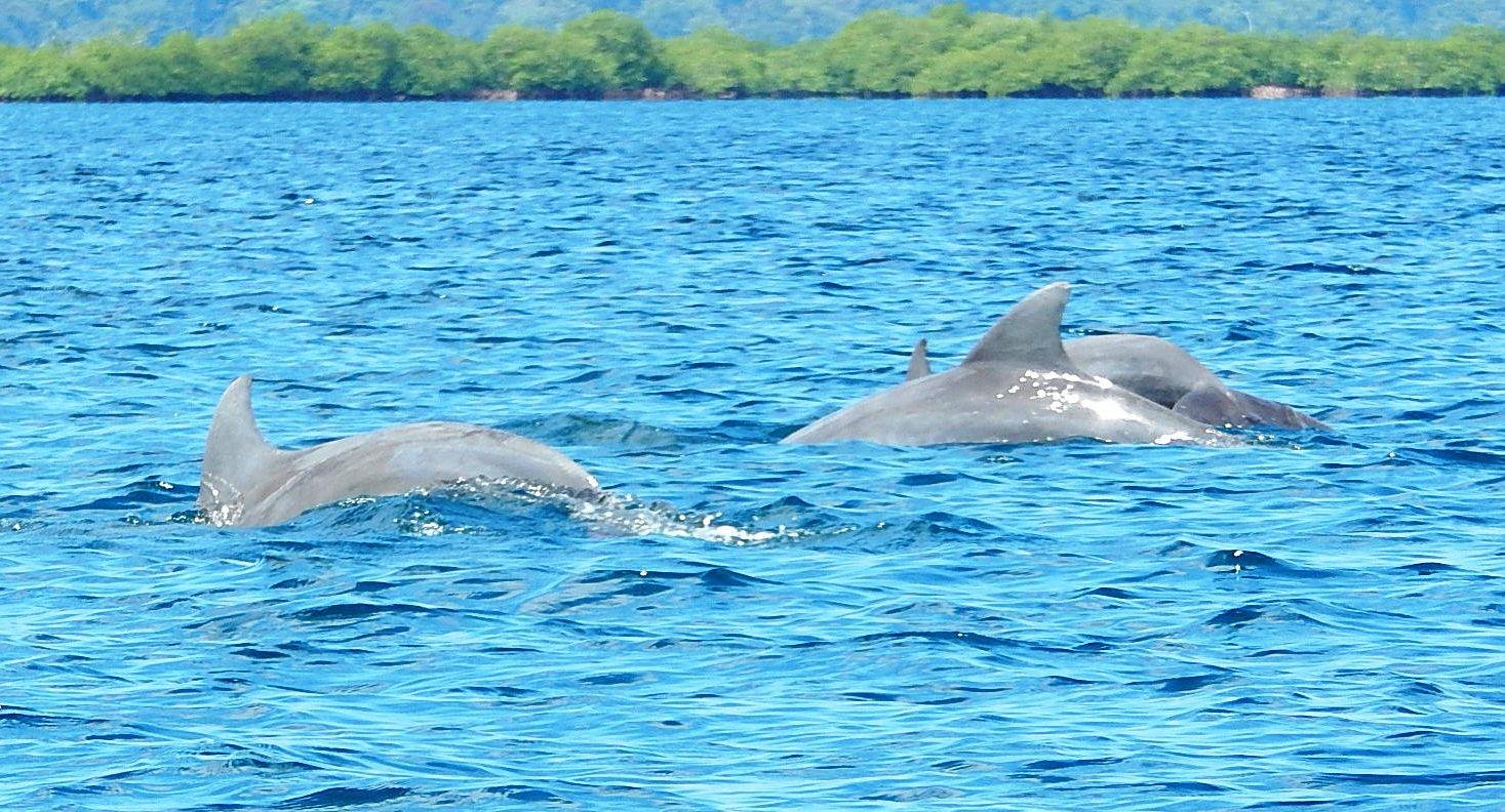
Dolphin Bay: a small population with close ties to home
In Dolphin Bay, or Laguna Bocatorito, near Isla San Cristóbal, bottlenose dolphins are part of daily life. They also belong to a small, distinctive population whose future depends on the health of these coastal waters.
A 2017 genetic study described the wider Bocas del Toro population as strongly isolated and cited an earlier estimate of about 80 animals. That figure is a historical estimate for the archipelago, rather than a current census of Dolphin Bay alone. The study identified a highly resident Dolphin Bay community alongside a more mobile community. It also documented concerns about heavy tourism traffic and boat collisions. The Bocas del Toro dolphin study.
Possible El Niño effects on these dolphins are indirect. Warmer water and changes in coastal habitats could affect the fish they eat. Those are risks to monitor, not confirmed impacts of this event on Dolphin Bay. Their strong attachment to local waters makes protecting feeding and resting areas especially valuable.
Boat disturbance is already a documented pressure. Researchers have found changes in dolphin whistles in the presence of dolphin-watching boats. Giving animals space and following local viewing guidelines are practical ways to reduce that pressure while scientists monitor environmental change. Research on dolphin-watching boats and communication.
What we can do before conditions worsen
The most useful response begins with decisions close to home. Forecasts can guide preparation, while local observations show when extra action is needed.
- In California: prepare for heavy rain, keep drainage routes clear and follow flood, coastal and burn-area warnings.
- For Panama’s forests and water: conserve water early, protect streamside trees and remaining forest, and strengthen fire prevention in vulnerable areas. Restoration should use native species suited to the site.
- For coral reefs: track heat-stress alerts and reduce pollution, anchoring damage and overfishing.
- For Dolphin Bay: follow boat-approach guidelines, avoid crowding dolphin groups, and support monitoring of calf survival, health and feeding conditions.
- After the event: keep monitoring and restoring habitats. Rain returning or ocean temperatures falling does not mean every ecosystem has recovered.
We cannot control the Pacific’s next turn. We can give forests, reefs and wildlife more room to cope by protecting the habitats and water they need, and by reducing the pressures already within our control.
See sea temperatures and reef alerts →
This article reflects information available on October 15, 2026. The forecast map is a saved snapshot from its stated issue date. Official source pages are updated regularly; later outlooks may differ.