A king tide is predictable. The coastline it reaches is changing. As the ocean warms and expands, exceptional high tides start from a higher level—bringing seawater farther into streets, neighborhoods and coastal ecosystems.
As October 2026 drew to a close, communities on America’s East and West Coasts faced the same troubling combination: unusually high tides arriving on top of elevated coastal water levels. South Florida’s water managers identified late October as a peak tidal period, while California agencies warned that El Niño, warm water and coastal waves were increasing flood and erosion risks. The astronomical timing was familiar; the higher ocean beneath it was the growing concern. South Florida’s October tidal outlook · California’s coastal-flooding preparations.
What makes a king tide?
“King tide” is a popular, non-scientific term for exceptionally high tides. Tides are driven mainly by the gravitational pull of the Moon and Sun. Higher tides commonly occur around a new or full moon, when those influences reinforce one another. When the Moon is also near perigee—its closest approach to Earth—the effect can be stronger. Seasonal and longer orbital cycles also shape the highest tides at a particular location. NOAA: What is a king tide?
These cycles can be predicted far in advance. But a tide prediction does not capture every influence on the water that ultimately reaches the shore. Wind, atmospheric pressure, ocean currents, waves and unusual ocean temperatures can lift or lower observed water levels. A high tide can therefore arrive higher than the astronomical prediction alone suggests.
Warm water takes up more space
What has changed is the height of the ocean itself. Global mean sea level rose about 20 centimeters—roughly eight inches—between 1901 and 2018. The two principal drivers are the expansion of seawater as it warms and the addition of water from melting land ice. An IPCC assessment attributes about half of the rise observed from 1971 to 2018 to thermal expansion. IPCC: ocean warming and sea-level change.
The oceans absorb more than 90 percent of the excess heat accumulating in the climate system. Because seawater expands when heated, even a modest warming spread through an enormous volume can produce a measurable increase in sea level. Melting glaciers and ice sheets add water as well. Together, these changes raise the baseline from which each high tide begins. Met Office: thermal expansion.
The practical consequence is straightforward: a tide that once stayed below a seawall or road can cross it when the starting water level is higher. Water can also back up through drainage systems. During the highest tides, streets may flood even when skies are clear.
El Niño adds a temporary lift
El Niño can amplify the problem along the Pacific coast. When tropical Pacific trade winds weaken, the distribution of warm water changes. Broad pulses called Kelvin waves move across the ocean and can continue along the Americas, temporarily raising coastal sea levels. The warmer water also expands.
These slow-moving changes are not tsunamis or breaking waves. They alter the background level on which ordinary tides and storm waves act. California’s October 2026 preparations explicitly identified Kelvin waves, elevated seas and strong offshore-generated waves as a coastal-flooding concern. USGS is also monitoring the 2026–27 El Niño’s coastal effects. USGS: El Niño coastal hazards.
The final water level at any beach or harbor reflects several processes acting together. It should not be attributed entirely to thermal expansion or to El Niño. On the Atlantic coast, winds, currents and weather patterns have their own effects. On both coasts, however, a higher long-term sea level makes it easier for a temporary increase to cause flooding.
From occasional disruption to repeated flooding
The costs reach well beyond a wet street. Roads become impassable, businesses lose access, and saltwater damages infrastructure. Repeated inundation can also harm wetlands and affect freshwater resources. What was once an occasional nuisance during the year’s highest tides becomes a recurring disruption.
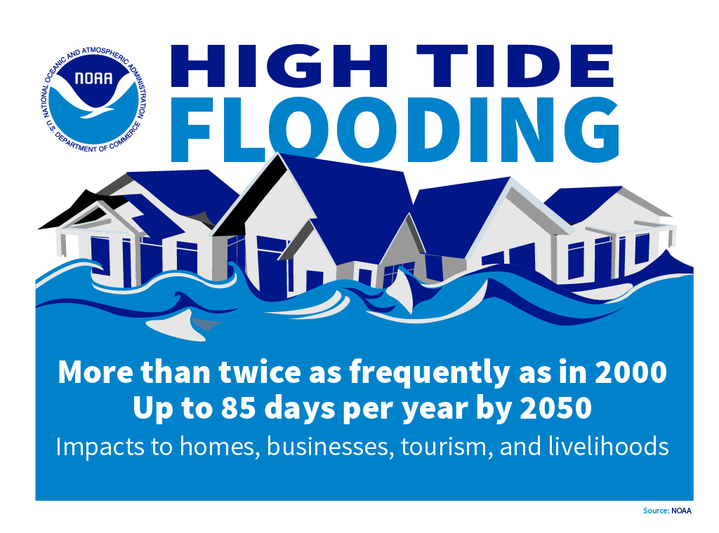
NOAA reports that U.S. high-tide flooding occurs more than twice as frequently as it did in 2000. Its published projections indicate substantially more flood days by mid-century, although the expected number differs from one place to another. Local elevation, land movement and the pace of relative sea-level rise all matter.
Longer lunar cycles will influence that future as well. A NASA-led study found that the tide-amplifying part of the Moon’s 18.6-year cycle, combined with rising seas, could produce a sharp increase in high-tide flooding along many U.S. coastlines during the 2030s. The Moon is not causing climate change; its familiar cycle is acting on an ocean whose baseline is rising. NASA: lunar cycles and future coastal flooding.
Why Bocas del Toro should pay attention
The same physics matters far beyond the United States. In Bocas del Toro, Panama, low-lying islands and shorelines are exposed to rising coastal water levels. Panama’s environment ministry has identified Isla Carenero, Changuinola and Bastimentos among areas vulnerable to projected sea-level rise. Its coastal studies examine conditions toward 2050 and support local adaptation planning. MiAMBIENTE: Panama’s sea-level-rise assessment.
That does not mean a U.S. flood-day projection can be transferred directly to Bocas del Toro, or that all coastal land will be permanently underwater by a particular date. Local tides, ground elevation, land movement, shoreline protection and the sea-level scenario determine the risk. Heavy rainfall can add another layer of flooding, but river and rain flooding should be distinguished from tidal inundation.
Ocean warming also puts pressure on coral reefs. Thermal stress can cause corals to bleach, weakening ecosystems that support fisheries, tourism and coastal protection. Protecting coastal habitats and tracking water conditions are therefore connected tasks: a changing ocean affects both the shoreline and the life beneath the surface. NOAA: coral bleaching.
Following the changing ocean with HERO
Ocean heat uptake, expanding seawater and the loss of land ice are raising the water level beneath natural tidal cycles. The lesson from a king tide is not simply that the Moon has pulled the water high. It is that a warmer, higher ocean leaves coastal communities with less room between an ordinary tide and a damaging flood.
Readers can follow sea-temperature information for Panama’s Caribbean and Pacific waters, and for San Francisco Bay, through HERO’s water-temperature resources. These observations provide context for changes in the ocean and for thermal stress on reefs; surface temperature readings alone do not measure sea-level rise or predict a local flood.
HERO’s River-to-Reef work connects land, rivers and coastal ecosystems. In Bocas del Toro, its mainland rainforest preserve and Casa de Theresa on Isla Cristóbal are separate properties. Together with ongoing research and education, this work gives readers a way to keep learning about the places and waters affected by a changing climate.